PostGIS
Description
Snaps the vertices and segments of a geometry to another Geometry’s vertices. A snap distance tolerance is used to control where snapping is performed. The result geometry is the input geometry with the vertices snapped. If no snapping occurs then the input geometry is returned unchanged.
Snapping one geometry to another can improve robustness for overlay operations by eliminating nearly-coincident edges (which cause problems during noding and intersection calculation).
Too much snapping can result in invalid topology being created, so the number and location of snapped vertices is decided using heuristics to determine when it is safe to snap. This can result in some potential snaps being omitted, however.
|
Performed by the GEOS module.
Availability: 2.0.0
Examples
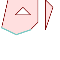
A multipolygon shown with a linestring (before any snapping) |
|
A multipolygon snapped to linestring to tolerance: 1.01 of distance. The new multipolygon is shown with reference linestring |
A multipolygon snapped to linestring to tolerance: 1.25 of distance. The new multipolygon is shown with reference linestring |
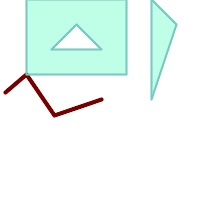
The linestring snapped to the original multipolygon at tolerance 1.01 of distance. The new linestring is shown with reference multipolygon |
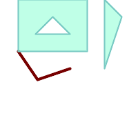
The linestring snapped to the original multipolygon at tolerance 1.25 of distance. The new linestring is shown with reference multipolygon |


